| Ekoportal |
|---|
|
|
Water resources
Regulations and International agreements
Surface water body monitoring on the Republic's territory is carried out in compliance with Azerbaijan Republic regulations and international conventions: “Water Code”, “About environmental protection”, “About environmental safety” Laws of the Republic of Azerbaijan and "Regulation on the rules of state monitoring of the environment and natural resources"." approved by the decision of the Cabinet of Ministers of the Republic of Azerbaijan dated July 1, 2004 No. 90, which regulates the implementation of these laws, The Convention on the Protection and Use of Transboundary Watercourses and International Lakes (Water Convention) and its Protocol on “Water and Health”.
Monitoring of water bodies
Observation posts
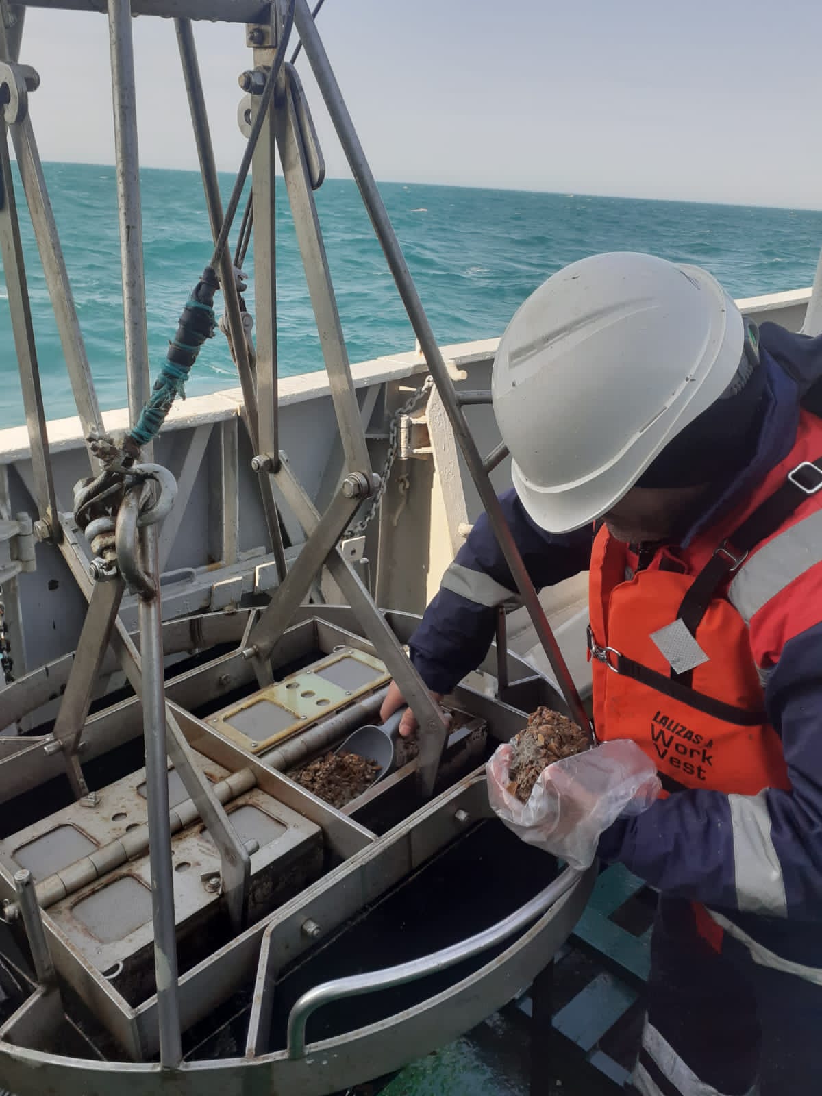
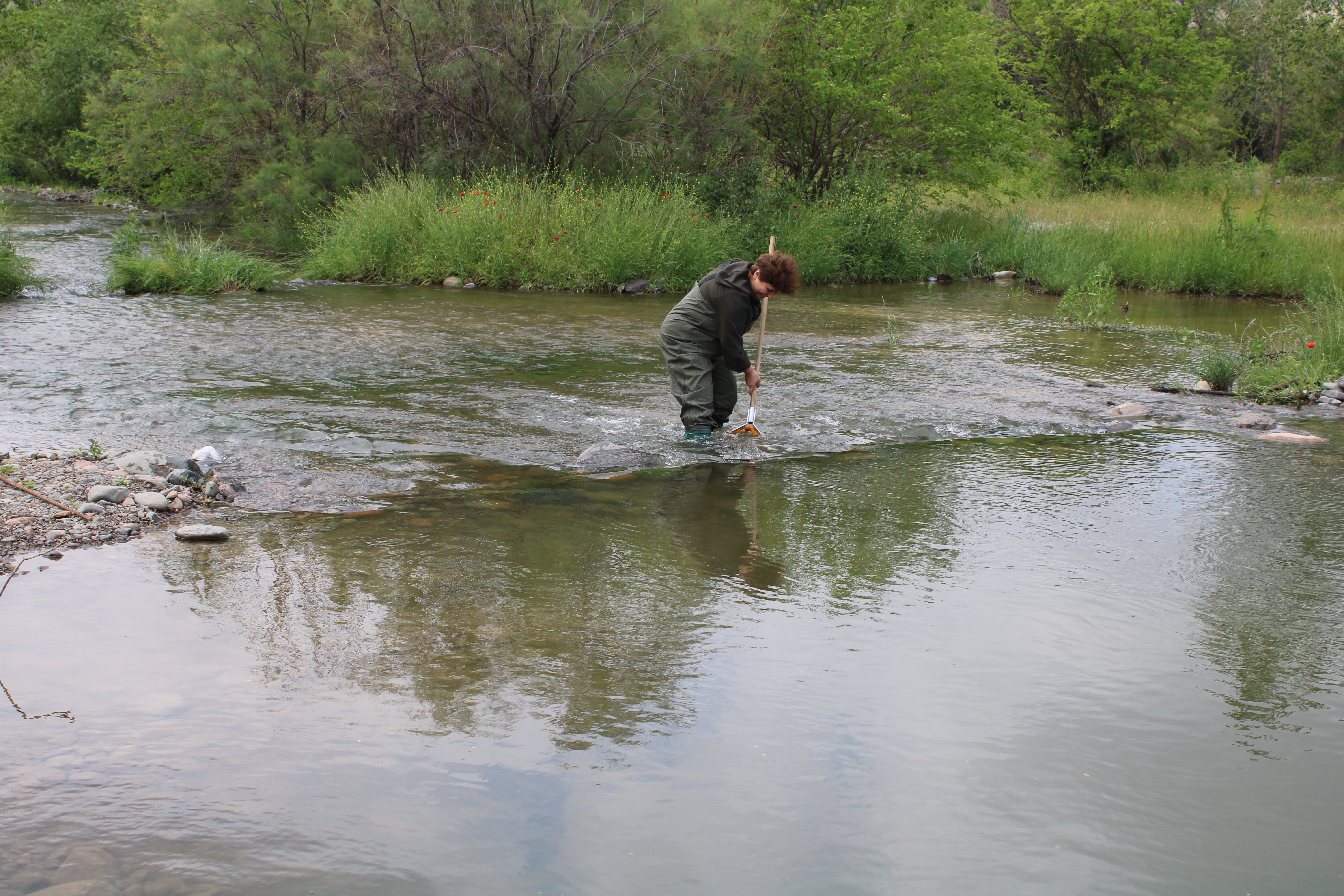
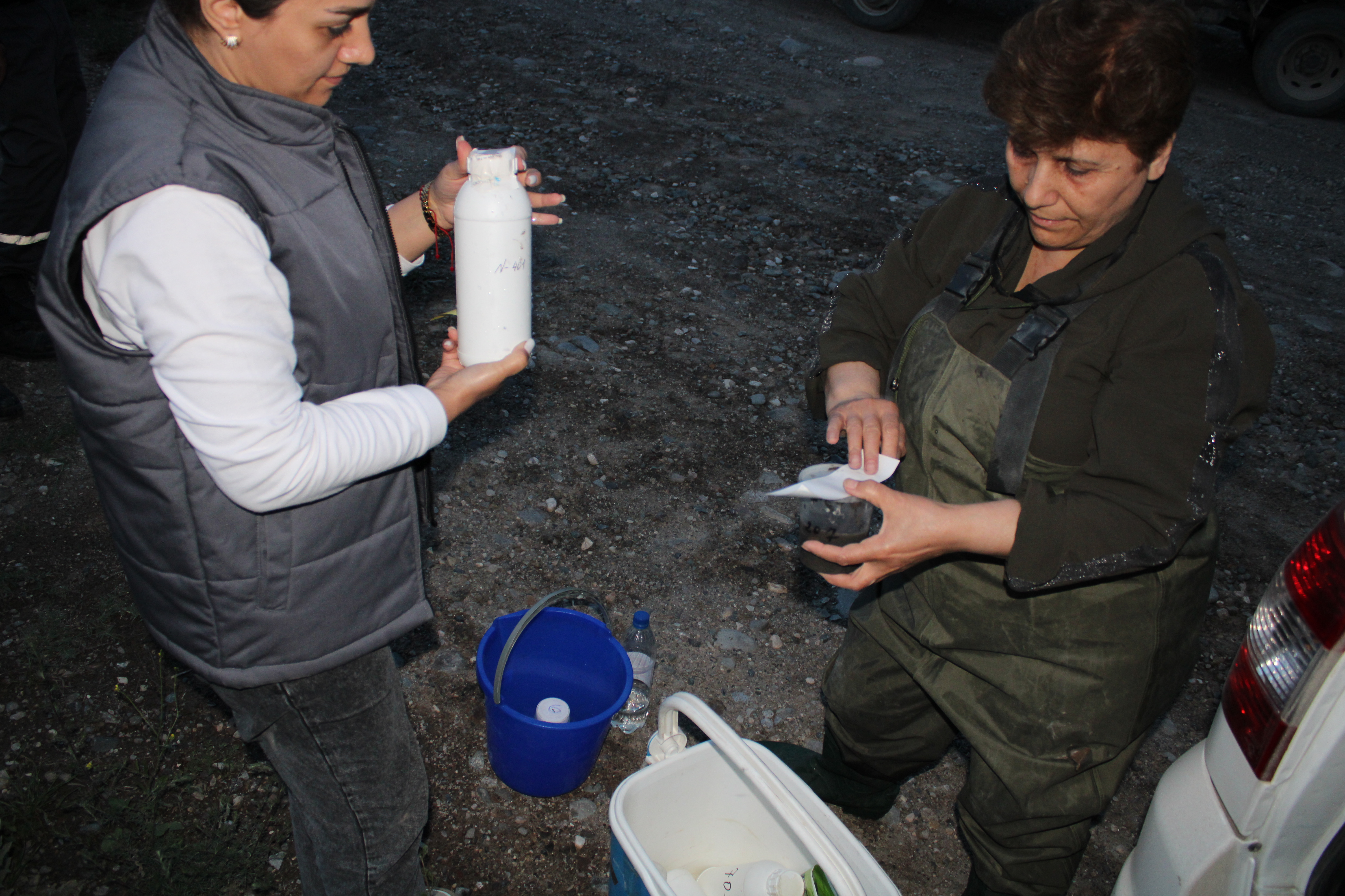
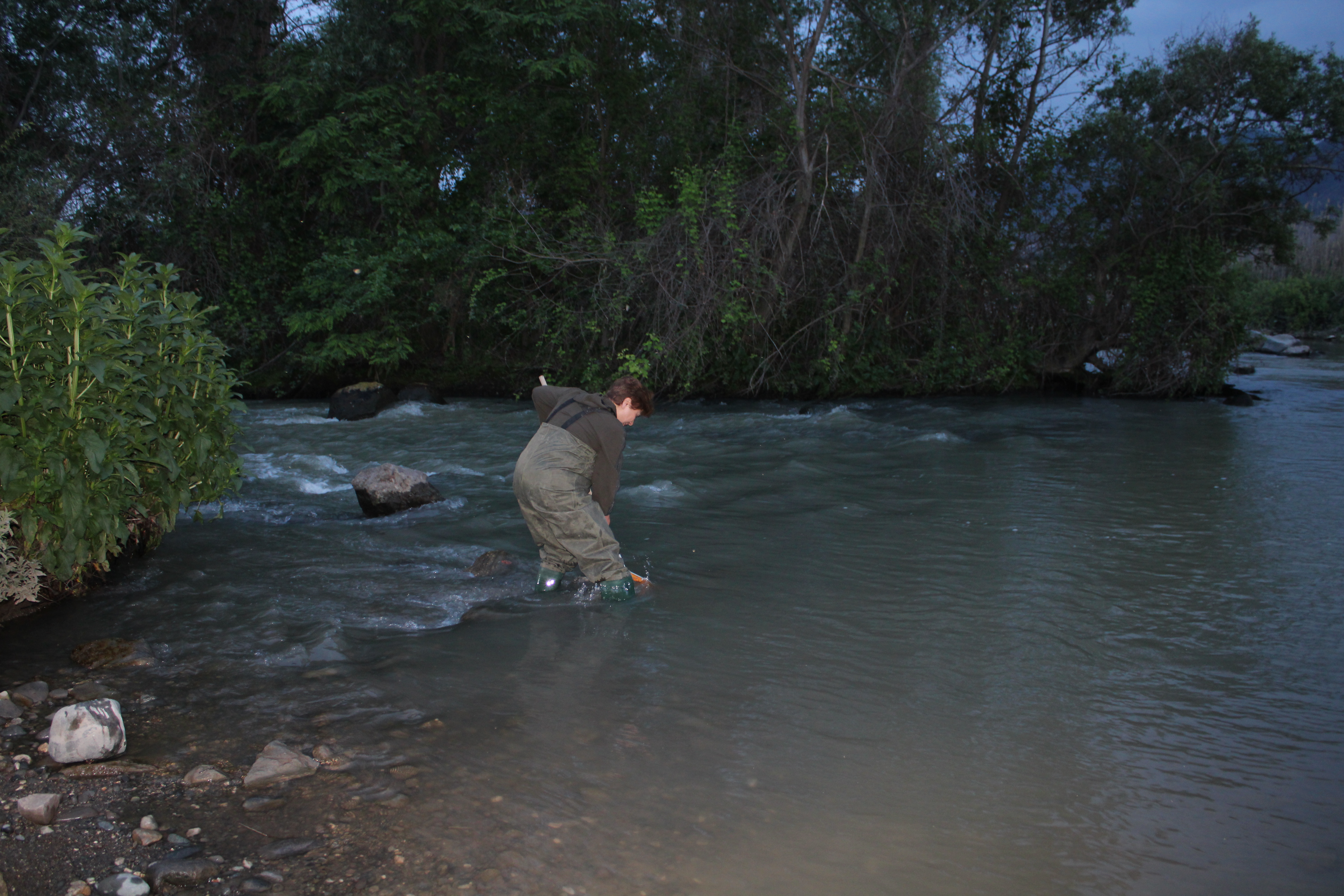
Monitoring of water bodies consists of timely detection of processes occurring in their state, evaluation of water bodies, forecasting the development of those processes and preventing their harmful effects, and regular monitoring and control of water body hydrological, hydrogeological, hydrobiological, and hydrochemical indicators in order to improve water supply and water protection systems. State monitoring of water bodies is carried out within the boundaries of the state water cadastre. The water cadastre is a collection of information on surface water bodies (rivers, lakes, aquifers, canals, ponds and glaciers), underground water bodies (wells, kahriz), underground water intakes, etc.), border water bodies, which are components of the unified state water fund, and also The section of the Caspian Sea (lake) belonging to the Republic of Azerbaijan, its water resources, use of water bodies and users of water bodies.
Monitoring the background composition and pollution of surface water bodies, which are part of water bodies, consists of analysis, evaluation and forecasting of changes in hydrological, hydrochemical and hydrobiological indicators of water resources in order to determine anthropogenic effects against the background of natural processes. The main purpose of monitoring the background composition and pollution of surface water bodies is to carry out the control of water quality indicators on a scientific basis for the protection of water resources, their efficient use and optimal management of surface water bodies. For this purpose, the following measures are required:
- organization of regular (systematic) monitorings on the background composition and pollution of the waters of the country's rivers, lakes and aquifers;
- calculating the balance of chemical substances and pollutants in water bodies, as well as organizing control over their entrance into our country from the flow of transboundary rivers from neighboring countries;
- evaluation and forecasting of the country's lakes, rivers, and aquifers pollution levels;
Permanent observation posts have been setup in the following areas of water bodies in order to evaluate and forecast the level of pollution in such areas:
-
in areas that are not affected by anthropogenic influence (by background composition);
-
where municipal waste water from urban centers and huge residential areas is released into a body of water;
-
where waste water from large industrial enterprises discharged into the water body;
-
in the parts of the collector - drainage water discharged to the water body from the irrigated agricultural areas;
-
in parts of water bodies important for fishing;
-
where transboundary rivers from neighboring countries enter the republic's territory;
-
in the parts of water bodies used for spa-health, recreation and sports;
-
at the mouths of large rivers.
Monitoring stations
Monitoring station classification
-
For the purpose of gathering essential and accurate data regarding the level of pollution in surface water bodies, monitoring stations have been classified into four categories, which are organized as follows:
-
I category observation points set up: in the areas of medium- and large-sized water bodies (aquifers and water streams) that are economically significant; near large industrial cities with more than 1 million inhabitants; in locations where especially valuable aquatic species spawn and spend the winter; in parts where emergency pollution cases are repeated; it is also organized in areas with heavy pollution as a result of excessive waste water dischargeI-category points can be set up in specific circumstances, in small aquifers and watercourses. In this category of points: monitorings on hydrological and hydrochemical indicators of the water environment are carried out every day; monitorings on 2-3 characteristic pollutants are carried out every decade of the month; monitorings on all possible pollutants are carried out once a month; full-scale monitorings of water background composition and pollutants are carried out in all phases of the hydrological regime (usually 7 times a year). Hydrobiological indicators - monitorings are made once a month on the indicators of phytoplankton, zooplankton, zoobenthos and periphyton, in addition to these indicators, macrophytes, photosynthetic intensity of phytobenthos and microbiological indicators are observed once every quarter.
-
II category observation points set up: population of 0.5 and -0.1 mln. in water bodies located in the city; in locations where rivers cross the state border of the Republic of Azerbaijan; in the habitats where aquatic creatures spawn and winter; Near dams important for river fisheries; collector-drainage and where industrial wastewater is discharged and disposed, in regions with mid-level water pollution and in river mouths. In the points: visual monitorings – carried out every day, monitorings on hydrological and hydrochemical indicators of the water environment - in every decade of the month, monitorings on all possible contaminants - once a month, full-scale monitorings of water background composition and pollutants are carried out in all phases of the hydrological regime (usually 7 times a year). Hydrobiological indicators - once a month on the indicators of phytoplankton, zooplankton, zoobenthos and periphyton, n addition to these indicators, macrophytes, photosynthetic intensity of phytobenthos and microbiological indicators are observed once every quarter.
-
III category observation points set up: in areas with medium and small settlements with a population of less than 0.5 million, and in water bodies located in areas where the population has mass recreation, in the areas where the low level of pollution is observed as a result of the organized discharge/disposal of various waste waters into the water body, at the confluences of large and medium rivers, At the mouths of the polluted tributaries of large rivers and aquifers. At these points, monitorings of hydrological and hydrochemical indicators of water and all possible pollutants are carried out once a month, and full-scale monitorings of water background composition and pollutants are carried out in all phases of the hydrological regime (usually 7 times a year). Monitorings on hydrobiological indicators are carried out once a month during the vegetation period on the indicators of phytoplankton, zooplankton, zoobenthos and periphyton, in addition to these indicators, macrophytes, photosynthetic intensity of phytobenthos and microbiological indicators are observed once every quarter.
-
IV category observation points set up: in order to study the natural background composition of water bodies in a stationary hydrological network, they are established in aquifers and parts of water streams that are not subject to pollution, as well as in water bodies in the territories of natural national parks and aquifers. Monitorings in these points are carried out in the main phases of the hydrological regime of rivers (lakes) (usually 7 times a year) in full volume on the chemical composition.
Surface water pollution monitoring periods
Surface water resources
General information on surface water resources
Azerbaijan's water resources are limited compared to other countries of the South Caucasus and cover only 15% of the water resources in the entire region.
The sources of surface water resources of the country are rivers, lakes, reservoirs and glaciers. Rivers are the primary source of surface water resources. 67-70% of river water reserves are formed in the territory of neighboring countries, and the rest (local flow) is formed in the internal rivers of our country. The total natural resources of river waters are 28.5-30.5 km3, water resources coming from neighboring countries through transboundary rivers are 19.0-20.5 km3, and local flow is 9.5-10.0 km3.
Water resources drop to 22.6-27.0 km3 during drought years. Accordingly, 17.1–14.3 km3 of these waters belong to transboundary rivers. The water resources of the Kura and Araz rivers decrease by 20% as a result of their use in the territory of neighboring countries. This leads to an increase in water shortage in the country (about 4-5 km3 per year) and creates difficulty in meeting the water demand in Azerbaijan.
Rivers, Lakes, Water reservoirs, Glaciers
Monitoring of surface water resources
Hydrological observations
The first hydrological observations in Azerbaijan were made in 1880 in the Salyan area of the Kura River. Stationary observations on the river flow started mainly after 1925. The number of measuring points has started to increase year by year. The expansion of the network of hydrological stations and points has created ample opportunities for organizing and conducting hydrological observations.
Currently, 88 hydrological stations are operating in the water bodies of the Republic (rivers, lakes and reservoirs). 80 of them are rivers, 6 are reservoirs, and 2 are lakes.
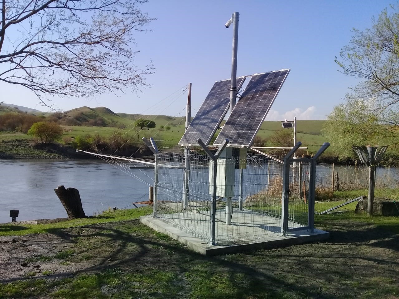
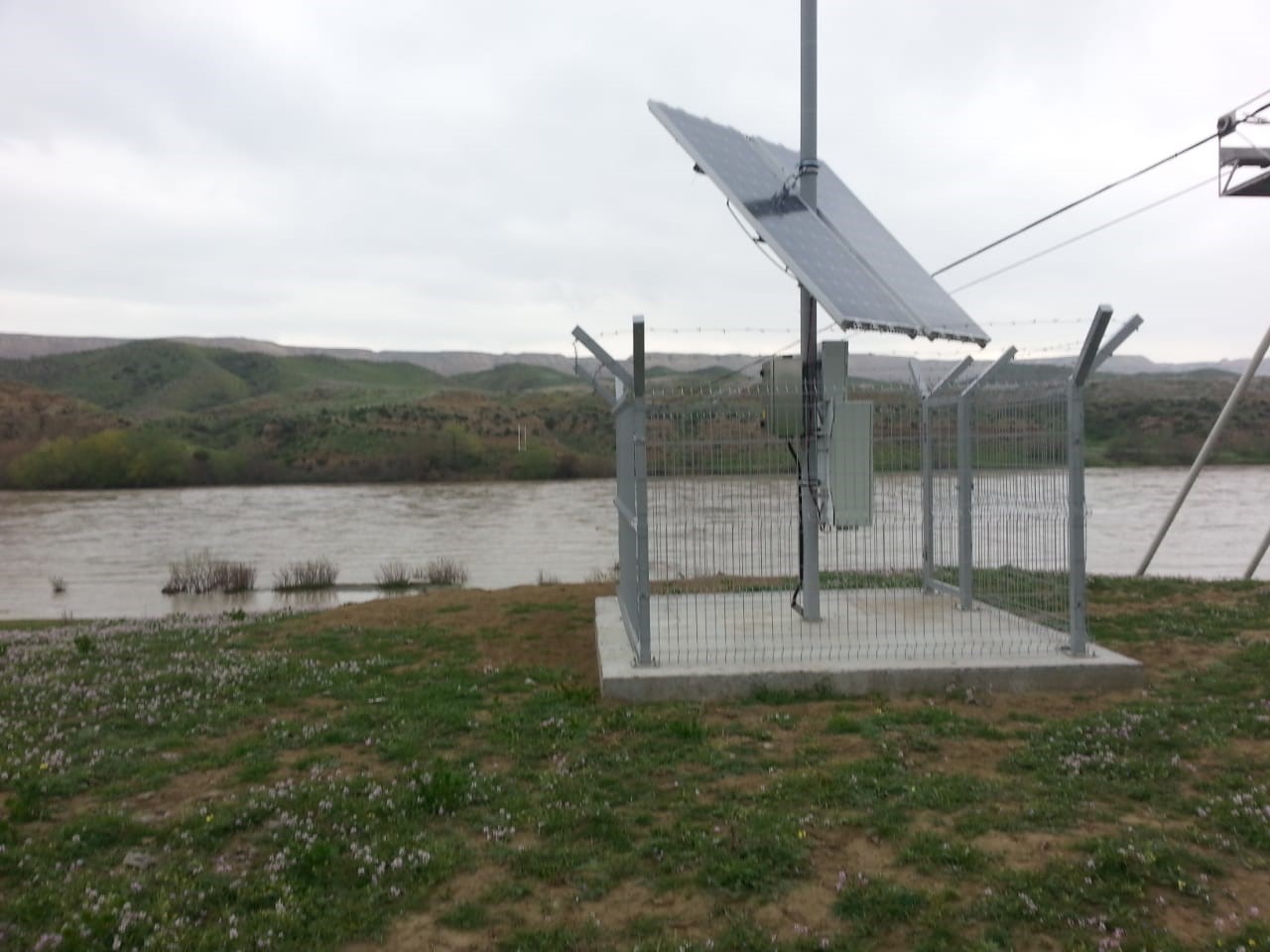
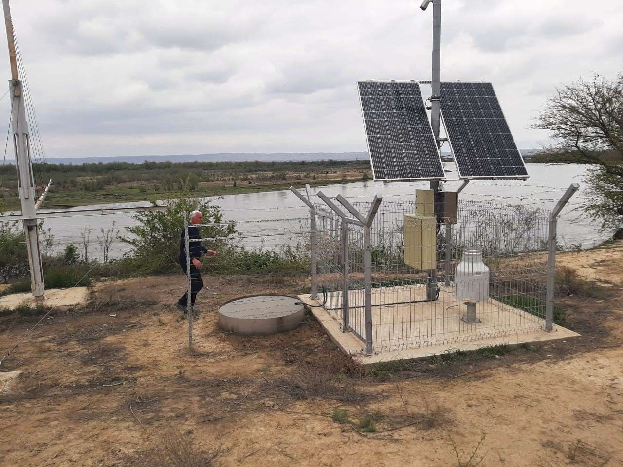
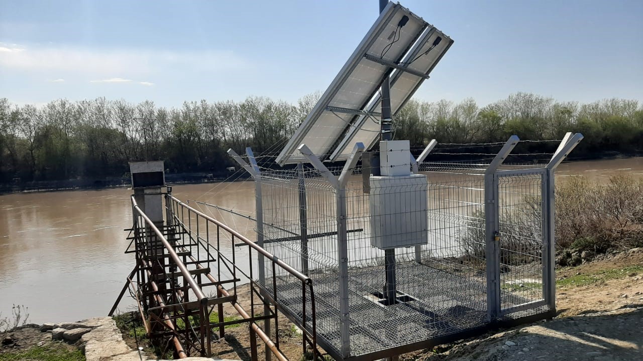
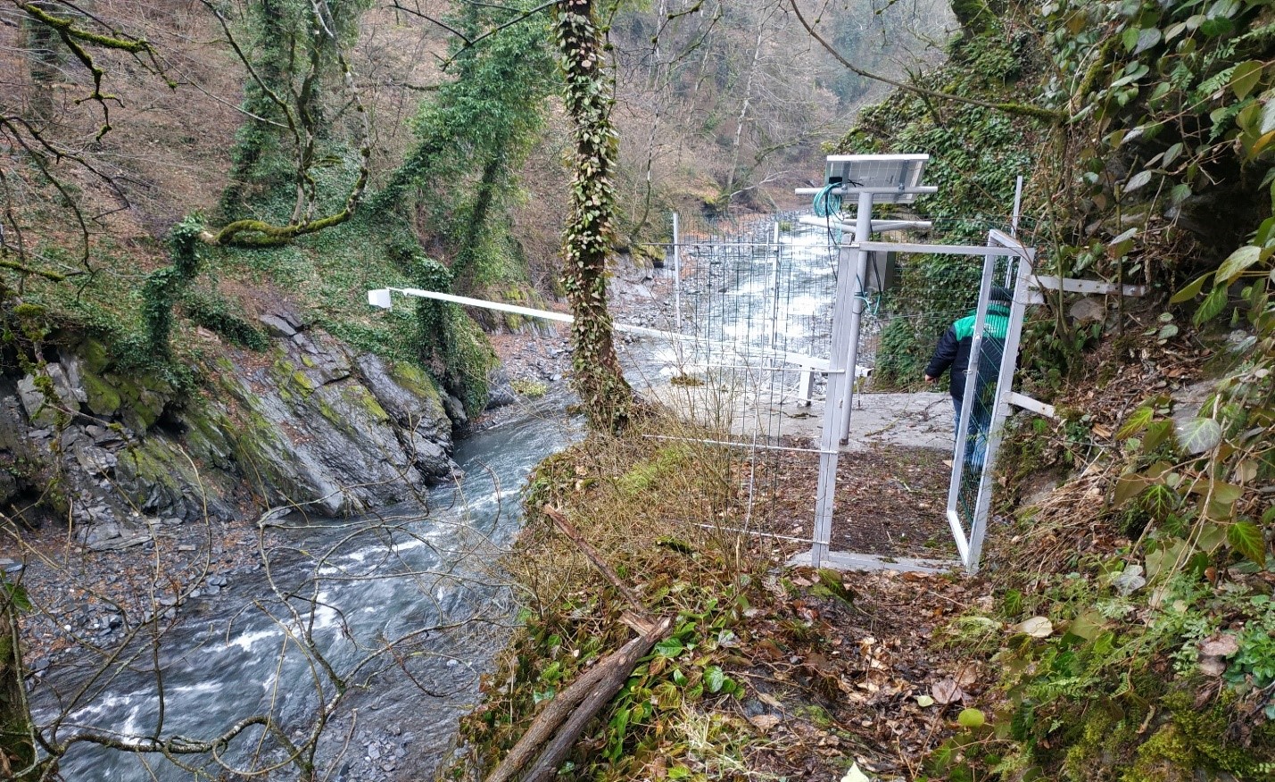
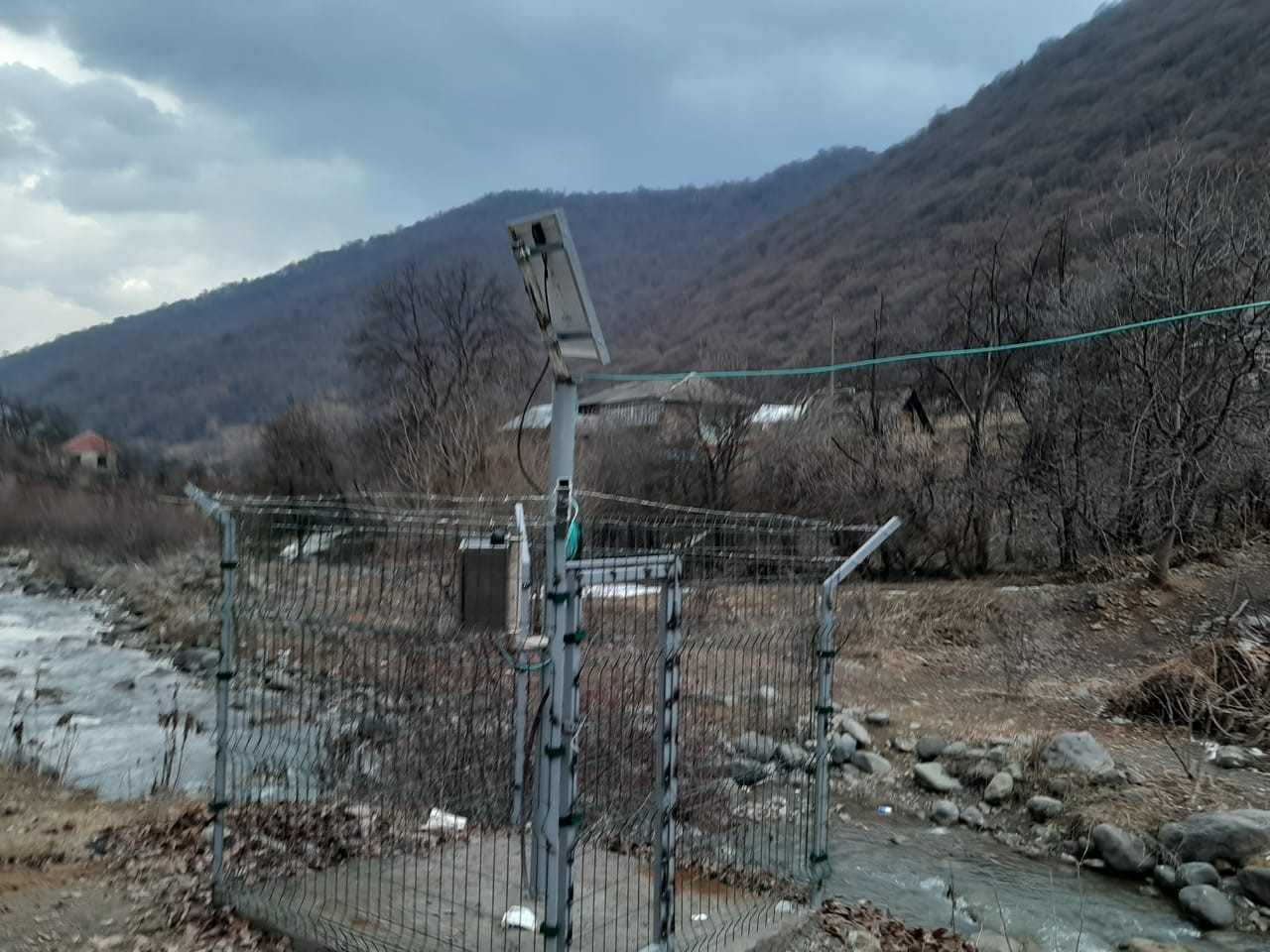
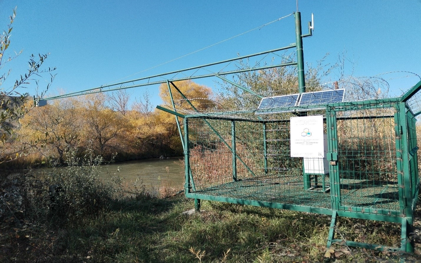
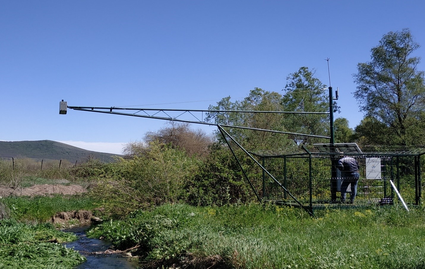
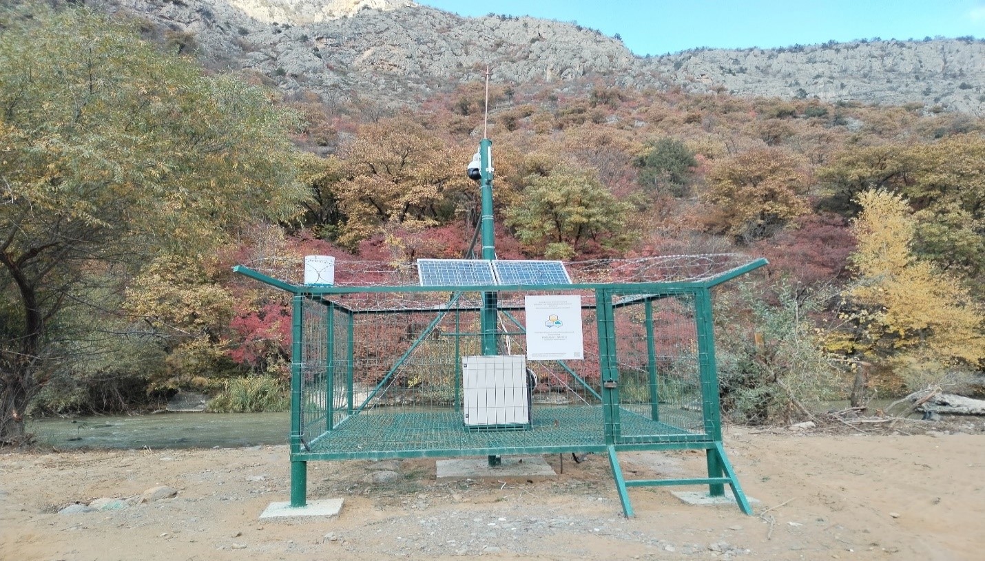
17 in the main rivers of the country (6 on the Kur river, 3 on the Araz river, Ganikh, Gabirri, Agstafachay, Shamkirchay, Tartarchay, Gusarchay, Vilashchay and Lankaranchay), 6 within the framework of the European Union Water Initiative project (Esrikchay, Zayamchay, Ganjachay, Kurekchay, Katekhchay and Ayrichay) modern automatic hydrological stations have been installed. Also, 6 automatic hydrological stations were installed on the Alicanchay, Turyanchay, Garasuchay, Garachay, Valvelachay and Gudyalchay rivers flowing through the territory of the Greater Caucasus.
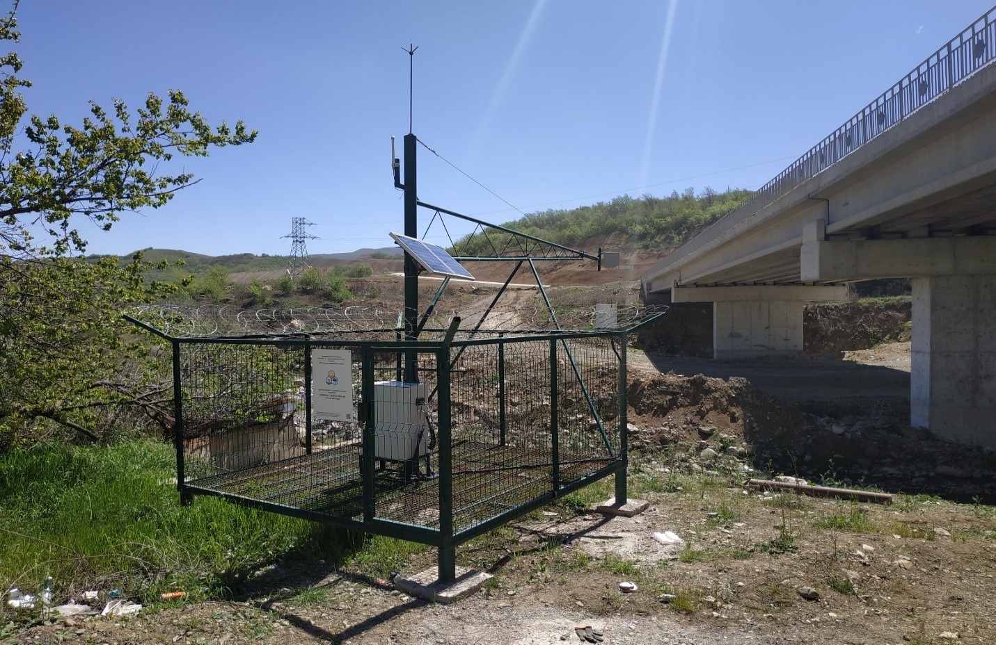
Starting from 2022, 11 modern automatic hydrological stations have been installed in 10 rivers (Tarterchay, Tutgunchay, Kondelanchay, Guruchay, Hekarichay, Zabukhchay, Bargushadchay, Okchuchay, Basitchat, Araz) in the Karabakh East Zangezur economic zone for the restoration of observations.
In total, the network is 45% automated by installing 40 automatic stations in 88 hydrological stations.
The National Hydrometeorological Service Situation Center's server continuously receives information from automatic stations, enters it, and displays it on a map on the monitor.
Automatic stations allow to assess the state of water resources in rivers at any time, as well as to monitor and determine the intensity of potentially dangerous hydrological events and at the same time, it allows watching the changes in the river during the day through a video camera.
Snow cover observations and general comparisons
Project information